|
Back to Homepage
Back to Travel
Photos
|
Belize:
Dec 2012 to Jan 2013
|
|
My friends and I rented
a car for the first part of our trip to Belize and drove about 800 miles
around the country. We started
in Belize City by the coast, traveled west to San Ignacio, then south to
the Mountain Pine Ridge area and the Caracol
ruins. Then we headed back to
the coast and drove south to Punta Gorda, then
north along the coast and down the isthmus to visit Placencia. Then we returned the car to Belize
City and boated to the island of Caye Caulker for
a week.
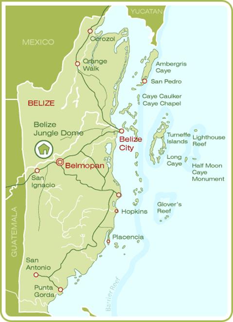
Belize, formerly British Honduras, is located on the north eastern
coast of Central America. It is the only country in the area where English
is the official language, although Kriol and Spanish are commonly spoken.
Belize is bordered to the north by Mexico, to the south and west by
Guatemala and to the east by the Caribbean Sea. Its mainland is about 180
miles long and 68 miles wide.
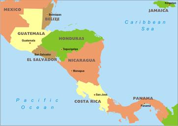
http://www.freeworldmaps.net/centralamerica/political.html
|
|
|
San Ignacio is the capital of the Cayo District in the western part of Belize. The population is largely Mestizo
and Creole (commonly referred to as Kriols who are descendants of English
and Scottish log cutters, as well as Black African slaves brought to
Belize). A sizable Mennonite community resides near San Ignacio. In 2009
the combined population was estimated at 20,000 people but a census in 2010
counted only 9,925 inhabitants in San Ignacio proper.
|
|
|
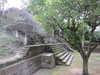
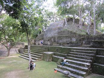
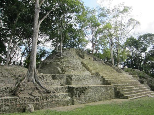
Cahal Pech is a Maya site located near the Town of San Ignacio. The site was a
hilltop palacio home for an elite Maya family,
and though most major construction dates to the Classic period, evidence of
continuous habitation has been dated to as far back as 1200 BCE during the
Early Middle Formative period (Early Middle Preclassic),
making Cahal Pech one
of the oldest recognizably Maya sites in Western Belize. The site rests
high near the banks of the Macal River and is
strategically located to overlook the confluence of the Macal
River and the Mopan River. The site is a collection of 34 structures, with
the tallest temple being about 25 meters in height, situated around a
central acropolis. The site was abandoned in the 9th century CE for unknown
reasons.
The name Cahal Pech,
meaning "Place of the Ticks," was given when this site was fallow
during the first archaeological studies in the 1950s, led by Linton
Satterthwaite from the University of Pennsylvania Museum. It is now an
archaeological reserve, and houses a small museum with artifacts from
various ongoing excavations.
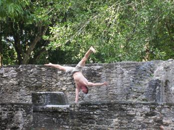
While
we were there, there was an American family doing acrobatics around the
ruins.
|
|
|
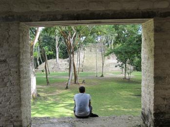
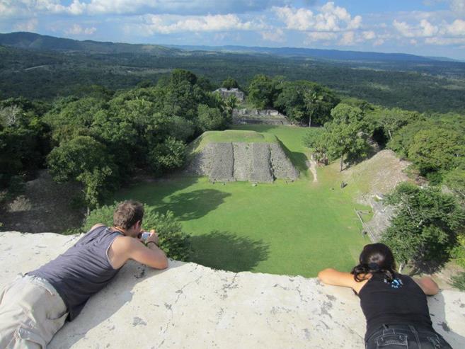
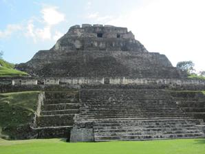
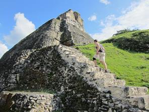
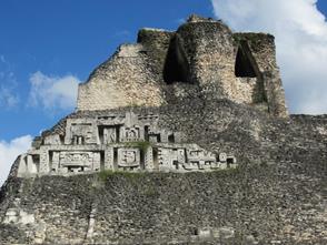
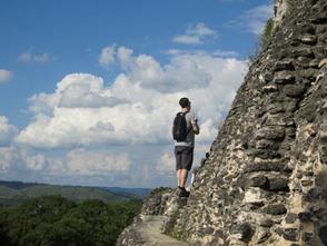
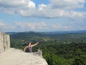
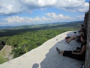
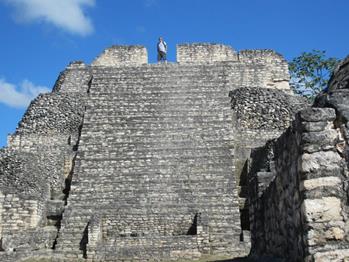
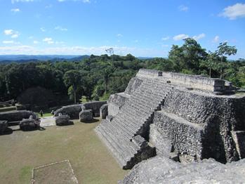
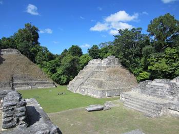
Xunantunich (pronounced shoo-NAHN-too-nich), or Stone Woman, is one of Belize’s most
impressive Maya ceremonial centers, and rests atop a natural limestone
ridge with a sweeping view of the entire Cayo
District and Guatemala countryside.
It was the first site in Belize to be opened to the public, when the
road and a ferry were built in 1954. What you will see today is a Classic period (300-900 AD)
ceremonial center, with large plazas ringed with pyramids. The tallest is
the 130 foot "El Castillo," (view from atop in large photo to
right) which is large by Mayan standards and is only exceeded by the Caana pyramid at Caracol. The
site was occupied until around 900 A.D. and was likely abandoned after an
earthquake, the evidence of which was discovered by archaeologists in the mid-1900's.
|
|
|
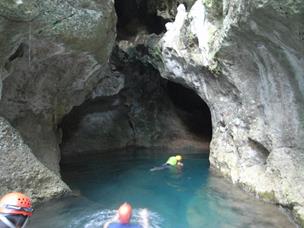
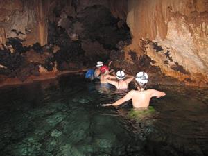
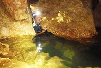
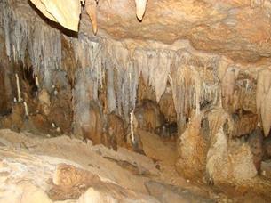
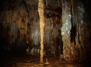
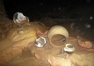
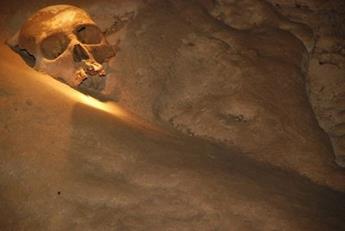
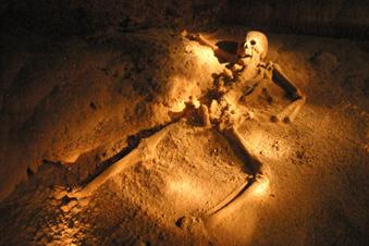
Actun Tunichil Muknal (Cave of the Crystal Sepulchre), also known locally as “Xibalba”
or ATM, is a cave near San Ignacio, Cayo District,
notable as a Maya archaeological site that includes skeletons, ceramics,
and stoneware. There are several areas of skeletal remains in the main
chamber. The best-known is "The Crystal Maiden," the skeleton of
a teenage girl (bottom right photo), possibly a sacrifice victim.
The ceramics at the site are significant partly because they are marked
with "kill holes", which indicates they were used for ceremonial
purposes. Many of the Mayan artifacts and remains are completely calcified
to the cave floor. The Mayans also modified cave formations here, in some
instances to create altars for the offerings, in others to create
silhouettes of faces and animals, or to project a shadow image into the
cave. The cave is extensively decorated with cave formations in the upper
passages.
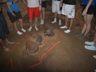
There are a limited number of guides licensed to take groups through. We had to wear helmets with
headlamps and swim into the cave with our shoes on. There were many narrow spots to get
through (see top right photo). At the end of the cave where the remains and
pottery are located, we left our shoes and went in our socks so as not to
slip and fall on the many artifacts.
|
|
|
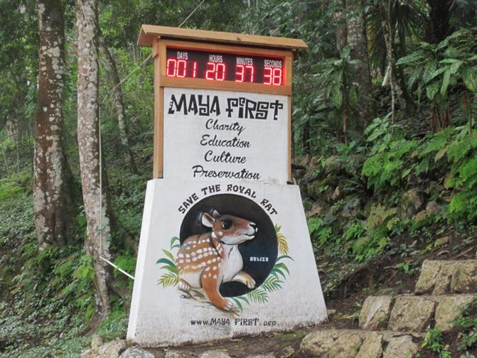
This was a countdown clock, with one day remaining, to the last day of
the Mayan calendar on 12-21-12.
Various astronomical alignments and
numerological formulae were proposed as pertaining to this date, all
unequivocally rejected by mainstream scholarship. A New Age interpretation
held that the date marked the start of a period during which Earth and its
inhabitants would undergo a positive physical or spiritual transformation,
and that 21 December 2012 would mark the beginning of a new era. Others
suggested that the date marked the end of the world or a similar
catastrophe.
|
|
|
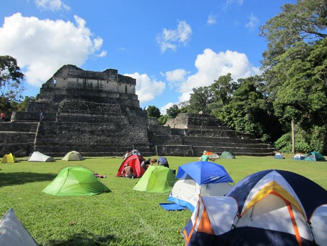
On the eve of the last day on the Mayan
calendar, we visited the Caracol ruins. They allowed 100 people to come camp
out at the ruins in tents to greet either the new start of or the end of
the world.
The Caracol area was
occupied as early as 1200 B.C., yet occupation in the epicentral
area was no earlier than 650 B.C. and lasted no later than A.D. 950. Caracol
boasts 53 carved stone monuments (25 stelae and 28 altars), and more than
250 burials and 200 caches. Its
ancient name is Uxwitza which translates as
"Three Hill Water" from which the Early Classic title Ux Witz Ajaw,
or “Three Hills Lord” was derived. This place name may also
reference the Three Stone Place of creation.
By the Early Classic (between A.D. 250-550) Caracol
was tied into extensive trade networks and pan-lowland ideological systems,
leading to a unified regional economy. The Caracol
was officially founded in A.D. 331 by Te’ K’ab Chaak.
|
|
|
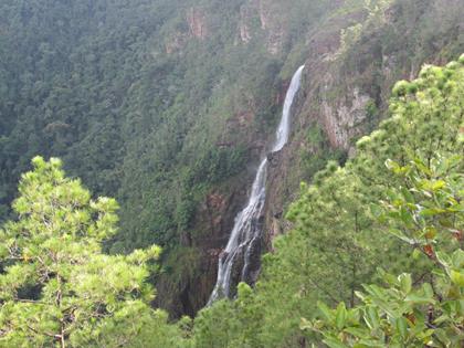
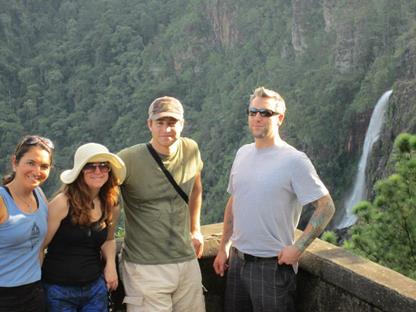
After visiting Caracol, we visited the Thousand
Foot Falls, which is actually measured at 1600 feet, in the Mountain Pine
Ridge Forest Preserve. This is
the tallest waterfall in Belize and Central America.
|
|
|
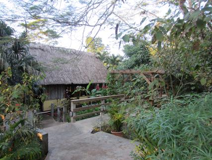
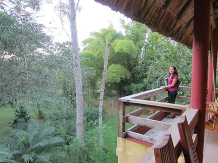
In the Mountain Pine Ridge area we stayed in a jungle lodge.
|
|
|
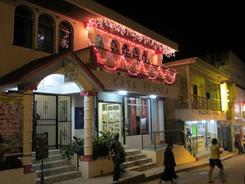
Punta Gorda, known locally as P.G.,
is the main town inf the Toledo District in
southern Belize. Punta Gorda is the southernmost
sizable town in the nation, with a population of about 6,000 people.
Although the town bears a Spanish name, its inhabitants are mostly
Kriol/English-speaking, primarily of Garifuna, East Indian, and Kriol
descent.
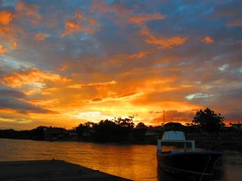
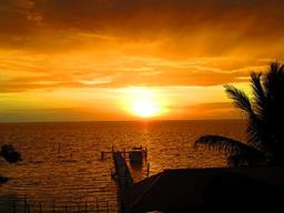
We arrived in Punta Gorda on 12-21-12 and watched
the sunset on what luckily proved to not be the last day of the end of the
world.
|
|
|
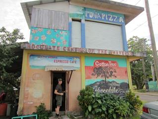
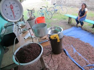
We had sampled the main chocolate
brand that is locally grown and made in Belize called Cotton Tree, and in
Punta Gorda we got to see the small place where they
made all of it. In the middle picture you can see how they take the beans
they have taken from the cacao pods, which are then fermented for a week,
and then they lay them out on that blue tarp to dry. Then they roast them and separate
the beans from the husk (you can do this by hand but they mill them using
the yellow hand drill to turn the mill). The leftover nibs are pulverized
and pressed and then rolled in a conch 1-3 days (far right picture). Finally the chocolate is poured into
molds and tempered by heating and cooling it.
|
|
|
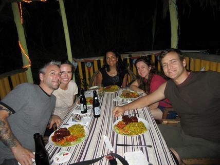
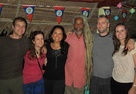
In Punta Gorda both nights we were there we ate
at an amazing vegetarian restaurant called Gormier’s. After dinner, Gormier, who is the
owner, the chef and a Rastafarian, posed with us with his dreadlocks down
which he has been growing for about 30 years.
|
|
|
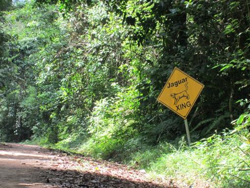
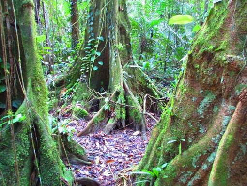
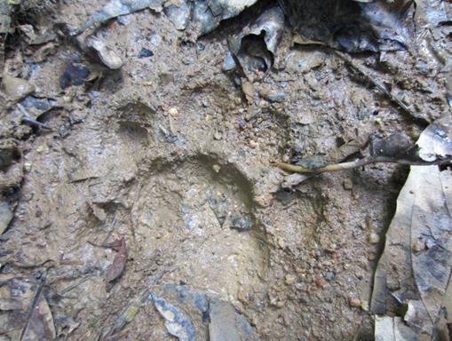
Cockscomb Basin Wildlife Sanctuary & Jaguar
Preserve
This unique sanctuary in
southern Belize covers an area of about 150 square miles of tropical
forest, and is the world's only Jaguar Preserve. Declared a Forest Preserve
in 1984 and finally a Jaguar Preserve in 1986.
The Jaguar is the third largest member of the cat family and endangered but
protected in this preserve. The
guidebook creepily said we wouldn’t see any jaguars in the day but
that they would see us: “These wonderful animals are masters of
stealth and their very existence is based on their seeing, but not being
seen.” All we found
was this jaguar paw print (bottom right).
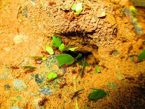
We also saw trails and trails of leafcutter ants.
Leafcutter ants are a species of ants that are fungus farmers
-- they grow their own food, a type of fungus, in underground gardens
(bottom left).
Leafcutter ants travel in long lines far into the forest, in
search of leaves; they leave a scent along the trail so they can find their
way back home. They use their sharp mandibles (jaws) to cut leaves from
plants, and then carry the large pieces of leaves over their back. A
leafcutter ant can carry almost ten times its own weight - that is like a
200-pound adult weightlifter carrying a 2,000-pound car up in the air. The
leafcutter ants carry the leaf pieces back to their underground nests where
the leaves are chewed into a pulp. The decaying pulp is stored with ant
feces and fungus spores, and strands of fungus eventually grow on the
decomposing pulp. This fungus is the crop that these ants eat; the ants do
not eat the leaves.
|
|
|
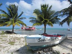
Placencia: In the 17th century, Placencia was settled by the English Puritans,
originally from Nova Scotia and latterly from the island of Providencia.
This settlement died out during the Central American wars of independence
in the 1820s.
The Placencia Peninsula was resettled in the
late 1800s by several families. Placencia
prospered and soon became a fishing village, earning its livelihood from
the sea.
The Spaniards that traveled the southern coast of Belize gave Placencia its name. At that time Placencia
was called Placentia, with the point being called Punta Placentia, or
Pleasant Point.
On October 8th, 2001, Hurricane Iris hit southern Belize with 145mph
winds causing major damage to nearly 95% of buildings in Placencia. Many developers took advantage of plummeted
real estate value and an increased development of the peninsula and Placencia proper is consistently on the rise, as well
as property value.
In the late 20th century it became a significant tourism destination,
and is now referred to as Placencia Village, or
simply Placencia.
|
|
|
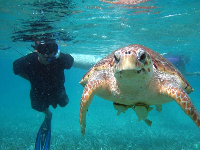
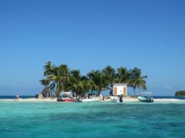
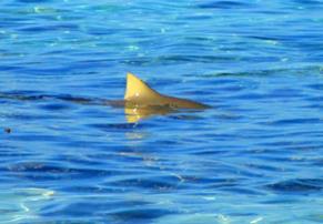
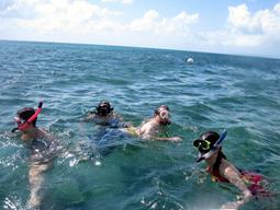
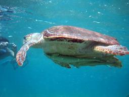
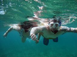
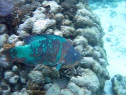
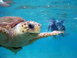
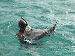
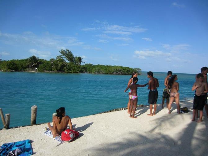
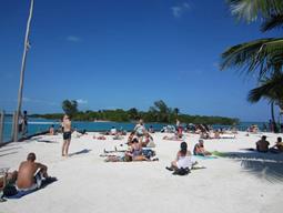
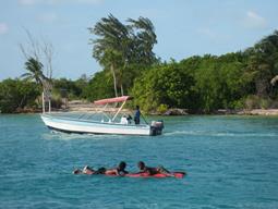
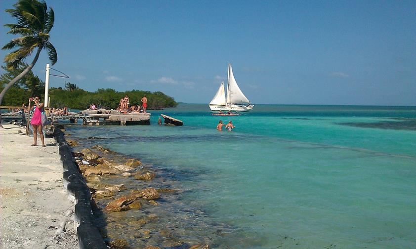
We went snorkeling a few hours
boat ride from Placencia and had lunch on the
tiny island of Silk Caye where a lemon shark
circled nearby as we ate. We
also got to swim with huge turtles that had sucker fish attached to their
bellies.
|
|
|
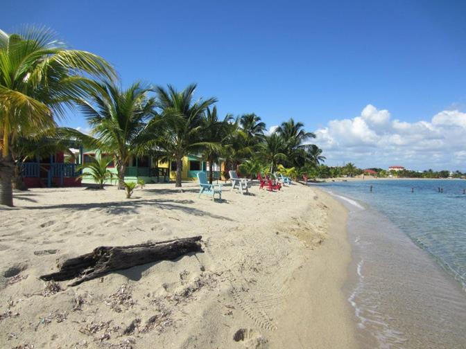
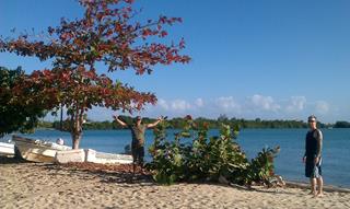
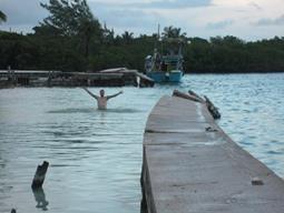
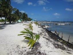
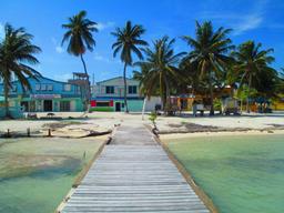
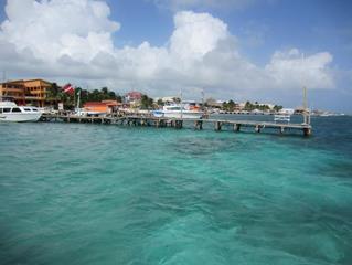
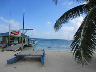
The island of Caye Caulker:
Caye Caulker is a small limestone coral island 20 miles off the coast of Belize in
the Caribbean Sea measuring about 5 miles (north to south) by less than 1
mile (east to west).
The island was
uninhabited as late as the 1830s. It wasn’t until the outbreak of the
Yucatán Caste War in 1848, when refugees fled Mexico by the thousands,
that people permanently settled on Ambergris Caye,
a few finding their way south to Caye Caulker.
Many of today’s residents can trace their family histories back to
the Caste War and even know from which region in Mexico their ancestors
originated.
Exact dates of settlement on Caye Caulker are
uncertain. The Reyes family tells of their great-grandfather, Luciano, who
arrived in Mexico from Spain and worked as a logwood cutter along the
coast. He fled with the rest and, after settling in San Pedro, eventually
purchased Caye Caulker for BZE$300. Over the
years, land was sold to various people; many descendants of the original
landholders are still prominent families on Caye
Caulker.
Accessible by high-speed water taxi or small plane. In recent years the
island has become a popular destination for backpackers and other tourists.
There are over 30 tiny hotels, and a number of restaurants and shops.
|
|
|
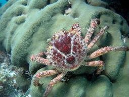
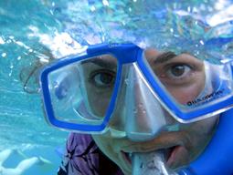
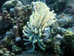
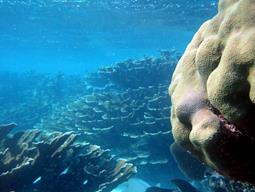
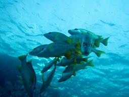
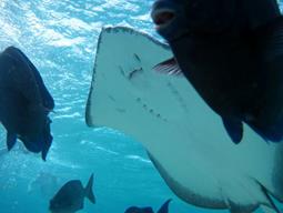
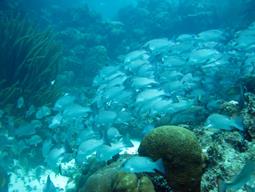
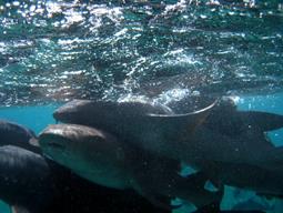
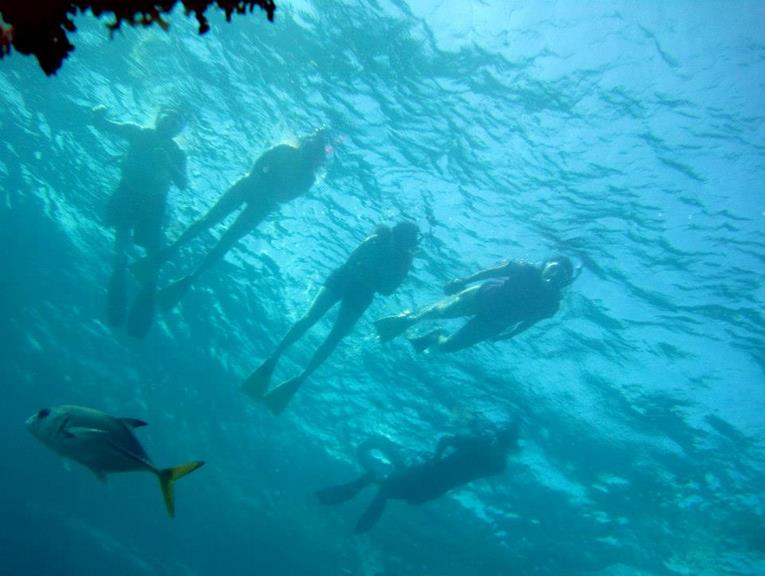
We went on an all day snorkeling trip near Caye
Caulker and our guide had an underwater camera so we got some amazing
pictures.
|
|
|
San Pedro is a town on the southern part of the island of Ambergris Caye about a half an hour boat ride from Caye Caulker. According to 2005 mid-year estimates, the
town has a population of about 12,400. San Pedro was granted the status of
a town in 1848. Its inhabitants are known as San Pedranos.
English is the main language spoken, however many people speak Spanish.
One of the primary industries in the town is tourism, most notably
scuba diving.
|
|
|
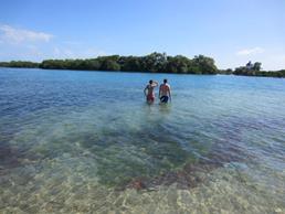
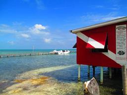
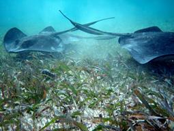
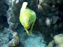
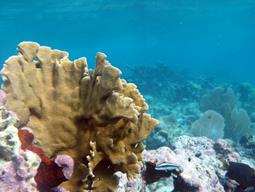
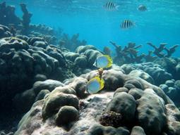
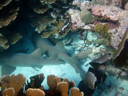
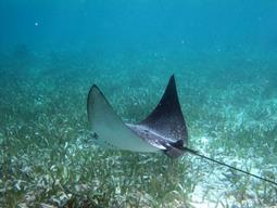
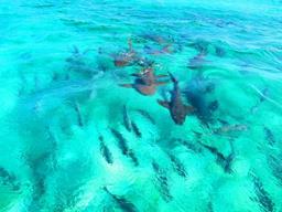
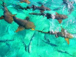
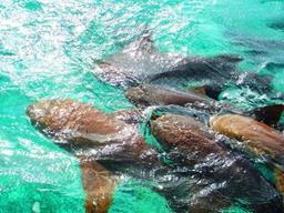
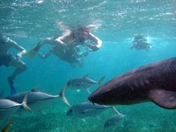
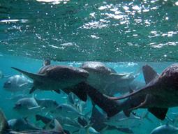
Hol Chan Marine Reserve and Shark Ray Alley:
Hol Chan Marine Reserve is a marine reserve close to Ambergris Caye
and Caye Caulker, off the coast of Belize. It
covers approximately 18 km² (4,448 acres) of coral reefs, seagrass
beds, and mangrove forest. Hol Chan is Mayan for
"little channel."
In 1999 the adjoining area of Shark Ray Alley was added as zone D of the
reserve. This is a second charged snorkeling area, but commercial and sport
fishing are permitted in some parts of this zone on obtaining a license.
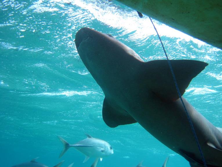
When we arrived at Shark Ray Alley, our guide Carlos, put chum in the water
to draw the sharks around the boat.
Then we all jumped in the water and watched them feed right next to
us. They were all nurse sharks
so harmless but it was still scary.
|
|
|
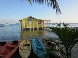
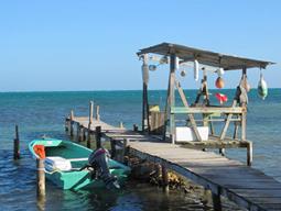
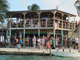
The Split on Caye Caulker:
A narrow
waterway known as the Split divides the island in two. There are different
stories as to how the Split came into existence, but most have to do with
the 1961 Hurricane Hattie that hit Caye Caulker,
killing 13 people, destroying all but 8 houses, and splitting the island in
two. Although it wasn't originally as large as it is now, the Split was
gradually made bigger by hand as people realized it would make for a very
convenient waterway.
Over the years, it has also become a very popular spot with both the
tourists and locals for the beach, the swimming, the snorkeling and the bar
called the Lazy Lizard (bottom right). The Lazy Lizard is where we
spent New Year’s eve as we rang in 2013.
|
|
|
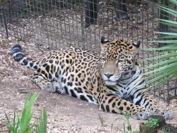
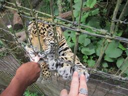
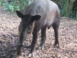
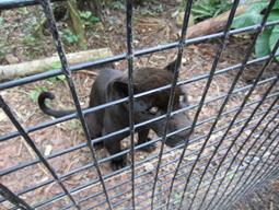
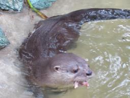
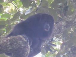
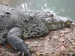
The Belize Zoo and Tropical
Education Center is settled upon 29 acres of tropical savanna and
exhibits over 150 animals, representing over 45 species, all native to
Belize. The zoo keeps animals which were orphaned, rescued, born at the zoo,
rehabilitated animals, or sent to The Belize Zoo as donations from other
zoological institutions. None
of these animals would survive if they were released back into the wild.
In the large picture is a jaguar relaxing in the heat of the day. We lucked out and were able to
follow one of the zoo keepers as he went around and fed the animals so we
got a lot of up close pictures of them.
Row 1 left:
me touching the jaguar’s paw.
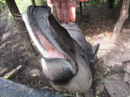
Row 1 middle and right: Belize’s national animal, the tapir,
who is related not to the anteater but the horse and rhino.
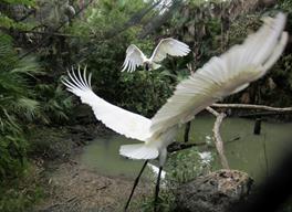
Row 2 left: Jambiru stork
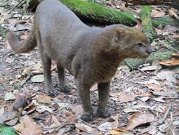
Row 2 middle: Jaguaroundi
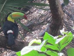
Row 2 right: Toucan
Row 3 left: Black jaguar
Row 3 middle: Ocelot aka “tiger cat”
Row 3 left: Neotropical river otter aka “water dog”
Row 4 left: Howler monkey
Row 4 middle: Crocodile
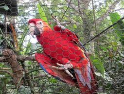
Row 4 right: Macaw parrot
|
|
|
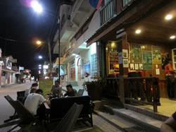
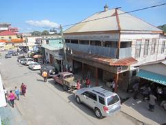
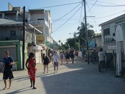
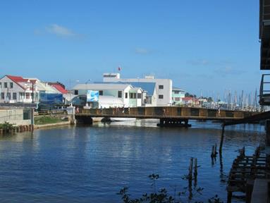
Belize City is the largest city in Belize and was once the capital of the former
British Honduras. Unofficial estimates place the population of Belize City
at 80,000 or more. It is located at the mouth of the Belize River on the
coast of the Caribbean. The city is the country's principal port and its
financial and industrial hub. Several cruise ships drop anchor outside the
port and are tended by local citizens. The city was almost entirely
destroyed in 1961 when Hurricane Hattie swept ashore on October 31st. It
was the capital of British Honduras (as Belize was then named) until the
government was moved to the new capital of Belmopan in 1970.
Top left is the swing bridge: The bridge requires a minimum of four
men to crank it by hand until it is parallel with the river. After river
traffic has passed, it is hand-cranked again until it has been returned to its
perpendicular position across the river. Traffic is halted for well over an
hour before the process is completed.
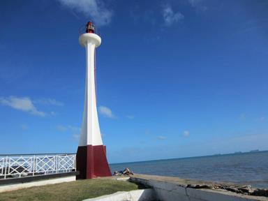
Top right: the Baron Bliss lighthouse established in
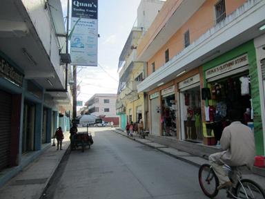
1885. Bottom pictures
are street shots as we walked to the bus terminal to head out to the zoo.
|
|
|