|
Back to Homepage
Back to Travel
Photos
|
Ecuador:
Dec 2011 to Jan 2012
|
|
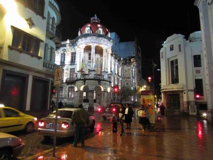
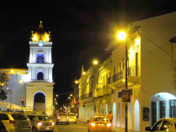
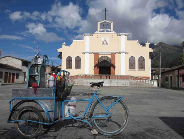
The main plaza in Latacunga, a city about 60 miles southwest of Quito, the
nation’s capital:
|
|
|
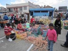
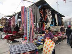
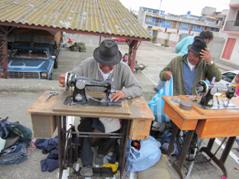
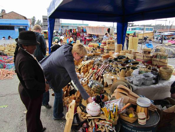
The market at Saquisilí, a small indigenous
town near Latacunga, which is considered one of the most authentic markets
in Ecuador. This is a
traditional highland market with vendors and locals arriving from villages
throughout the central Sierra to buy, barter, and trade for food, household
items, herbs, tools, animals, etc.
|
|
|
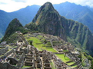
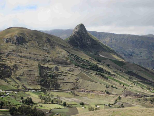
Outside
of Tigua on the Quilotoa Loop which is a 124 mile loop (200 km) outside of
Latacunga where you pass through beautiful isolated mountain villages. They say this landscape pictured
here is reminiscent of the famous site of Incan ruins, Machu Picchu, in
Peru:
|
|
|
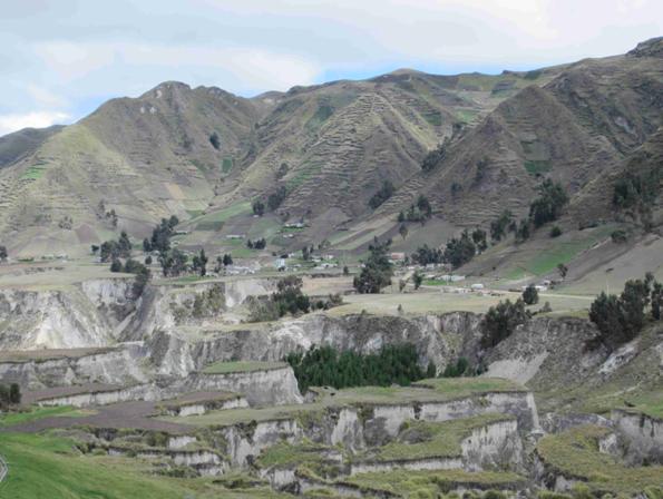
Landscape along the Quilotoa Loop.
With all the rain that Ecuador gets, canyons have formed here at the
base of these mountains from water erosion.
|
|
|
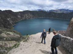
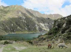
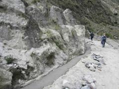
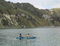
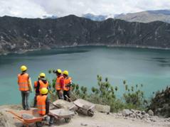
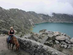
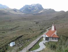
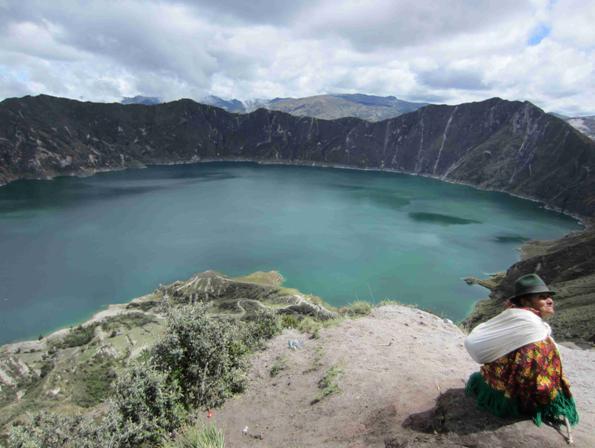
Laguna (Lake) Quilotoa, a high
mountain caldera (at about 13,000 feet or about 4,000 meters) was formed in
the broad crater of this now extinct volcano due to a catastrophic eruption
800 years before. The lake is
now 820 feet deep (250 meters).
The hour hike down was relatively easy but steep and slippery in places
(top left). On the walk down
you could see workers using rocks and cement to help prevent landslides
(top center and top right). At
the base at the lake (bottom left), you could kayak on the lake (bottom
center). We attempted to hike
back up but having just arrived in the country and going from sea level to
13,000 feet elevation in a day, we were quickly winded and instead rented
horses to ride back to the top (bottom right),
|
|
|
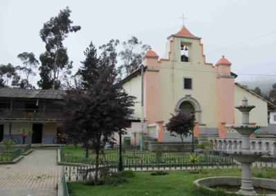
Chugchilan, a small pueblo on the Quilotoa Loop near Quilotoa Lake where
we stopped to have lunch.
|
|
|
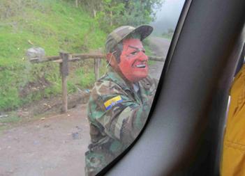
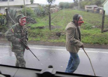
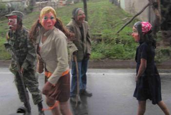
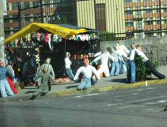
In the days before New Year’s there is a tradition in the small countryside
towns of creating an impromptu road block with a wooden pole lift up gate,
and the townspeople don masks and costumes and ask the cars for coins to
pass.
You can imagine our concern when we were first stopped by these guys in
military outfits with masks and what looked like guns but our driver just
laughed and handed them coins.
We went through about 4-5 of these road blocks on this day and in
one place quite a few of the townspeople had come out to watch the antics.
|
|
|
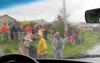
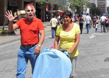
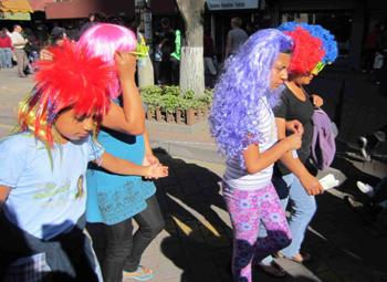
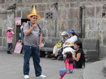
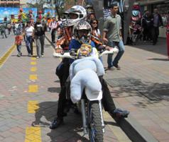
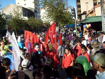
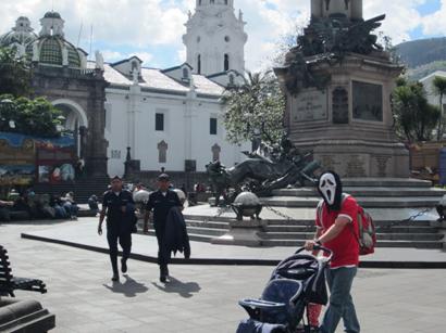
In the larger town of Quito, the capital, we saw more New Year’s
traditions such as people dressing up in masks, witch
hats and colorful wigs and strolling about with
their families.
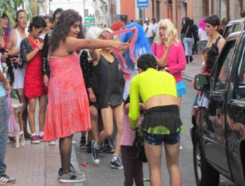
In Quito, we also saw a spin on the road block tradition but in this case,
groups of men dressed up in drag, blasted music, and danced in the street
stopping cars who then had to pay a few coins to pass (bottom right).
|
|
|
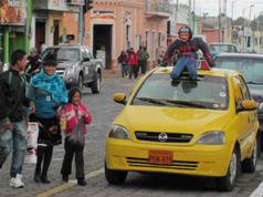
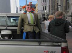
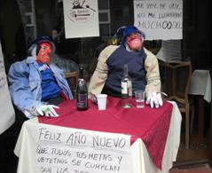
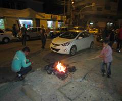
Yet another New Year’s tradition we
saw throughout Ecuador was the tradition of the muñeco (doll or
puppet). In the days leading up
to New Year’s we saw what looked like bodies being sold on the street
corners (top left). And we saw
these stuffed doll effigies with human masks and clothes strapped to cars
(top center), in the back of cars (top right), strapped to the fronts of
motorcycles (bottom left), and even set up at tables on the street (bottom
center).
We were told that some were stuffed with newspaper and others with
fireworks. Then they set fire
to them (bottom right) to release all the bad energies from the previous
year so they can begin the next year with a fresh start.
|
|
|
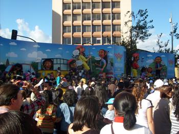
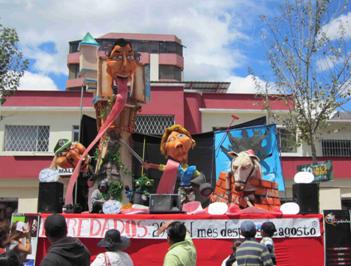
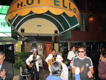
In Quito, we stayed in a hotel on
a central street called Avenida Rio Amazonas
which the city closed off several miles of to traffic on New Year’s
eve. First thing in the
morning, we were woken up by live bands and the streets were already
filling up with people.
Every few feet there were also stages set up with enormous papier-mâché images, some with political
messages, some just for laughs (top left and top center).
When we returned to our hotel in the afternoon, we found a band and people
dancing in the entryway (bottom right).
|
|
|
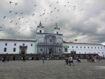
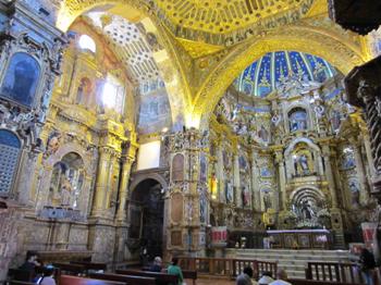
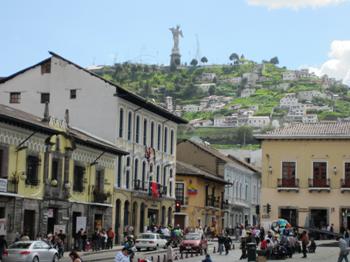
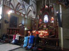
The Monastery of San Francisco from the outside and inside (top left
and top right) in the Plaza San Francisco in Old Town in Quito. In the bottom right picture, you can
see the 135 foot tall statue of the Virgin Mary with the unusual addition
of angel wings, on the Mirador de Panecillo overlooking Quito.
|
|
|
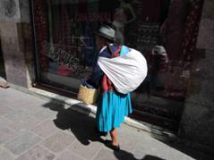
Images around Old Town Quito.
In the center, you can see an indigenous Quichuan
woman in traditional dress of skirt, long braided hair and Panama hat. With a population around 2.5
million, the Quichua groups of South American
Indians are the largest of any American Indian group in the World today.
|
|
|
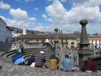
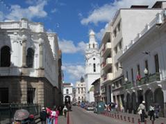
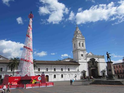
Different plazas in Old Town Quito.
Plaza de Independencia on the left (with
another masked Ecuadorian on New Year’s eve) and Plaza Santo Domingo
with the Iglesia (church) of Santo Domingo.
|
|
|
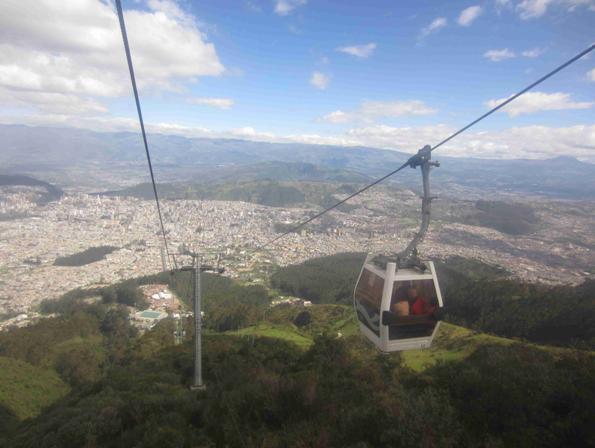
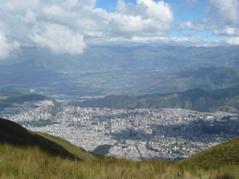
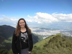
The TelefériQo (from teleférico and Quito), is a gondola lift
in Quito, Ecuador, running from the edge of the city center up the east
side of Pichincha Volcano to lookout Cruz Loma. It is one of the highest
aerial lifts in the world, rising from 3,117 m (10,226 ft) to 3,945 m
(12,943 ft). The ascent takes about eight minutes, traveling 2237 linear meters.
At the top, there are sweeping views of Quito and there is Catholic church
(center).
|
|
|
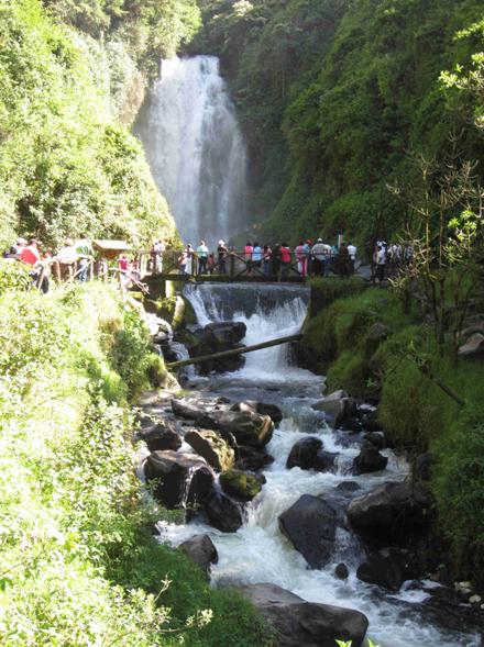
Cascada de Peguche (Peguche waterfall) in Peguche,
Otavalo.
|
|
|
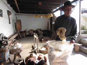
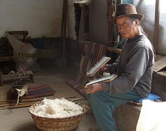
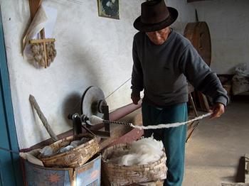
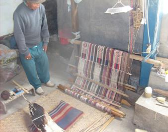
In Agato, Otavalo we visited the home of a master weaver named
Miguel Andrango who showed us how he did
everything by hand from washing, cleaning and combing out the cotton to
spinning it into thread and then using a loom with a backstrap
to make hand woven articles. He
told us this tradition is getting lost so he and his family are currently
trying to open a school to teach the next generation.
|
|
|
Central plaza and church of Peguche, Otavalo
|
|
|
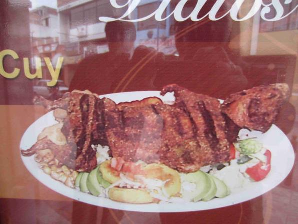
A cuy
is a South American guinea pig. The tiny animal is revered in Ecuador
culture and is utilized in several ways, primarily as a food source (as
seen here from a picture on a menu where you can see it is served whole). It is also used in spiritual practices
and healing ceremonies, performed on the patient by a healer or
shaman, also known as a yachak.
|
|
|
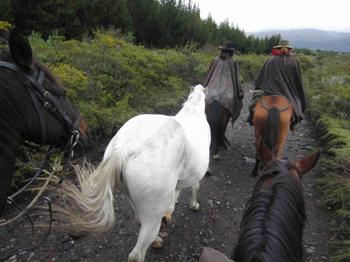
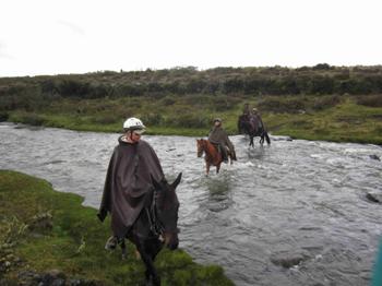
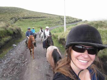
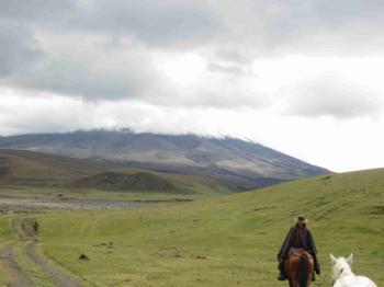
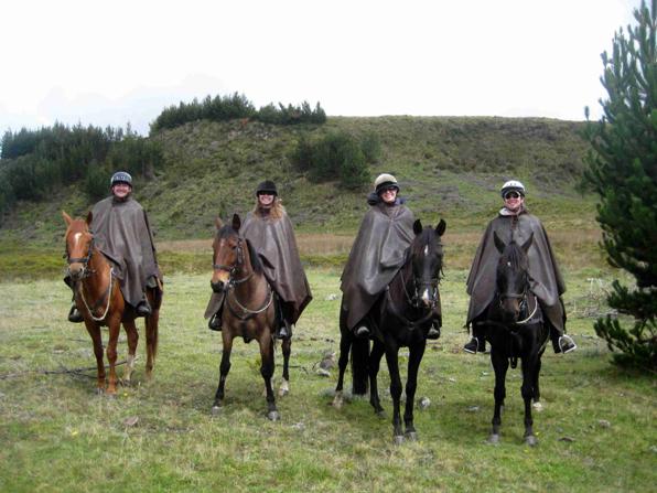
We went on a two-day horseback ride
to the Cotopaxi volcano. Rising to 19,347 feet (5,897 meters), it is the world’s highest
continuously active volcano. Cotopaxi has an almost perfectly symmetrical
cone, interrupted only by one minor cone—the Cabeza
del Inca (“Inca’s Head”). This snow covered volcano is
located on the Eastern Cordillera of the Ecuadorian Andes, 60 km south of
Quito and 35 km northeast of Latacunga.
Cotopaxi has erupted more than 50 times since 1738. The most violent
historical eruptions of Cotopaxi volcano were in 1744, 1768, 1877, and
1904. At the moment, it has been dormant for over 70 years, which is an
unusual long interval in its recent history.
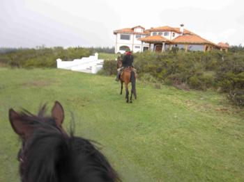
After the first day, we rode up to a hacienda where we stayed the night
before continuing the ride to Cotopaxi the next morning (middle left).
The day we approached the volcano, it rained intermittently (which is why
we’re all wearing rainproof ponchos) and the top half of the volcano
was obscured by clouds but you can see the base and where the snowline
begins (bottom left).
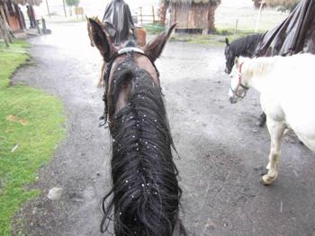
At the very end of the ride it hailed briefly as you can see the hail in my
horse’s mane (bottom right).
Our guide joked that only in Ecuador can you experience all four
seasons in one day.
|
|
|
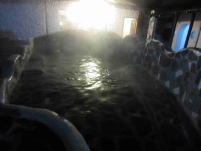
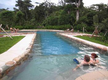
After horseback riding for 2 days we
went to the town of Papallacta and relaxed in the
steamy hot spring fed pools there.
|
|
|
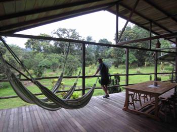
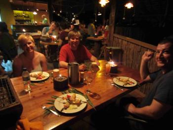
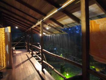
Next
we stayed in a jungle lodge in part of the Amazon rainforest outside of Tena which is located in the Oriente
providence which is southeast of Quito.
|
|
|
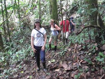
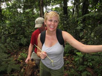
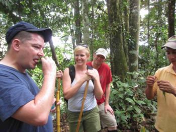
We did a three hour hike through
part of the rainforest with a Quichuan
guide. There were some deep
muddy parts so we all wore rubber boots on the hike which is very commonly
seen footwear in the more rural parts of Ecuador (top left).
Our guide showed us how to make a strong food masher from one of the forest
plants (top right). He also had
us taste some ants that actually tasted like lemons (bottom right).
|
|
|
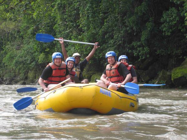
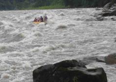
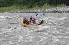
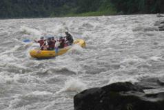
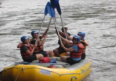
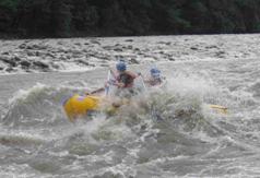
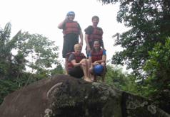
We rafting 27 kilometers (about 16
miles) down the Napo river.
|
|
|
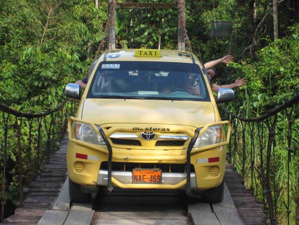
More harrowing than rafting was sometimes taking taxis through winding
mountain roads where they would often pass cars on blind curves or here
taking the taxi across a rickety looking rope bridge.
|
|
|
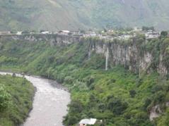
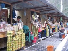
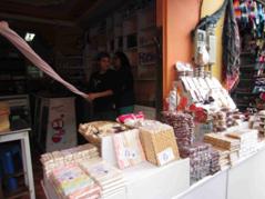
Different images in the town of Baños de Agua Santa which is located at the
foot of the Tungurahua volcano.
There were many stalls throughout the town selling sugar cane and
candy made from the sugar cane.
|
|
|
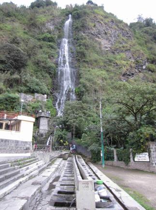
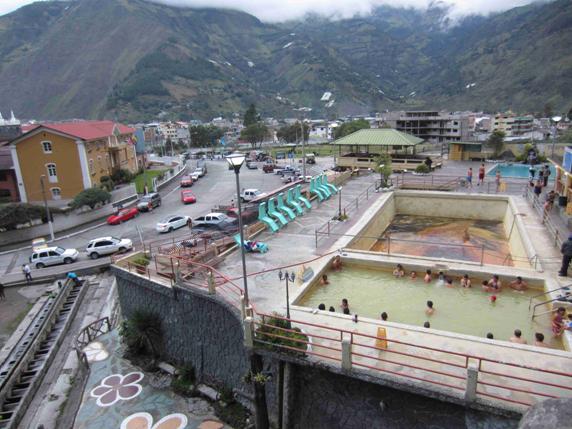
The waterfall in Baños called Chorrera
de la Virgin (left) which has a line of public wash basins at its base fed
by the waterfall where people can wash dishes and clothes.
The waterfall is next to the public pools (right) fed from the thermal
waters from the Tungurahua volcano (hence the town name Baños
or baths).
|
|
|
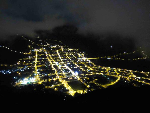
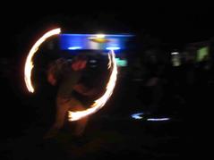
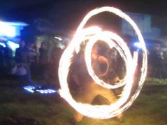
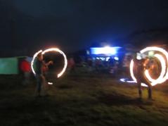
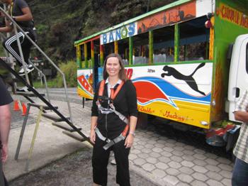
We took a Chiva
(colorful bus with music and flashing lights) to a mountaintop overlooking Baños to see the Tungurahua volcano and its
flowing lava by night but unfortunately it was too overcast to see the
volcano so we enjoyed the view of the city and the fire dancing
performance.
|
|
|
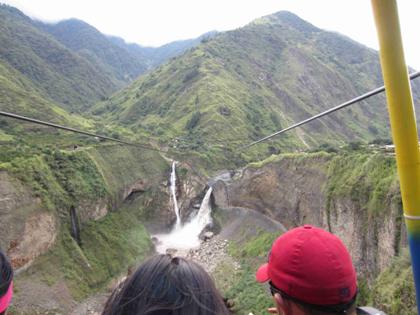
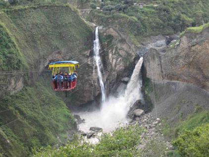
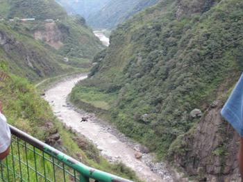
We took a tour of the many
waterfalls around Baños and got close to these ones by taking this gondola ride across the
canyon.
|
|
|
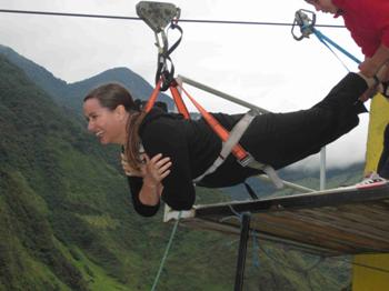
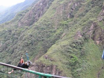
The same day we rode a
zipline that was 1 kilometer (0.6 of a mile) long
and about 400 feet high over a river through a canyon. A big group went right before I did
so there were no helmets left when I went!
|
|
|
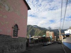
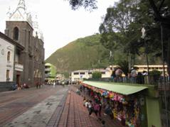
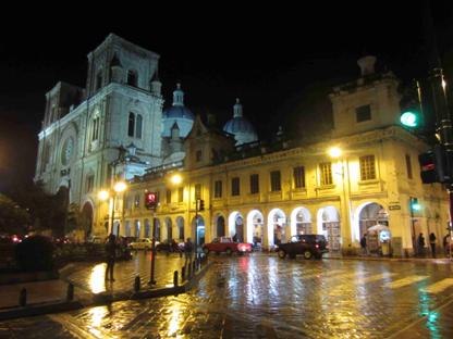
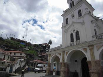
Located in southern Ecuador, the town of Cuenca, Ecuador’s 3rd
largest city, is a colonial era city where a good
deal of the city’s colonial architecture (churches, plazas, and
buildings) remain intact. Cuenca
is a UNESCO World Heritage Site.
On the right is the Catedral Nueva (New
Cathedral) located in the historical heart of Cuenca on Parque
(Park) Calderón. Construction began on the cathedral
in 1885 and was completed 80 years later.
|
|
|
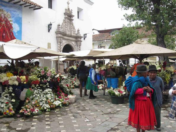
Iglesia (Church) del Carmen de la
Asunción in Cuenca. They
hold the Flower Market in front of the church. In the early part of the 20th
century, women weren’t allowed to work. To create a diversion for them, the
men of the city decided to set up a market for the use of women only. Nowadays, anyone can wander through
the market. Ecuador is one of
the world’s largest exporters of flowers.
|
|
|
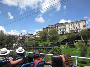
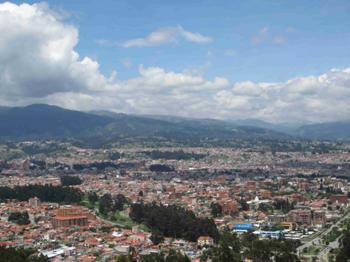
We took an open-topped
bus tour of Cuenca. Here you
can see some people on the bus wearing the popular Panama hats, which
originated in Ecuador (top left).
And you can see a monument to the many volcanoes in Ecuador (top
right). We went to the Mirador de Turi (bottom left)
to see sweeping views of Cuenca with its many red roofs (bottom right).
|
|
|
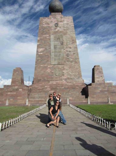
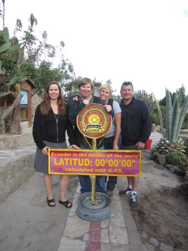
La Mitad del Mundo (the Middle
of the World) monument. Here
you can see the dividing line between the two hemispheres painted on the
ground and visitors can stand with one foot in each hemisphere straddling
the equator.
The monument (on the left) was established in 1736 by a French explorer who
made calculations to determine the precise equatorial line. With modern GPS technology, they
found that the exact dividing line was off by 600 feet (180 meters).
On the right, we are standing at the true dividing line with latitude
00’ 00’ 00”.
Here there were a series of interesting exhibits that let you try balancing
an egg on its end (easier at the equator), and they showed how when you
drain water on either side of the equator it swirls down the drain but
directly on the equator, it drains straight down.
|
|